Survey & Laser Scanning
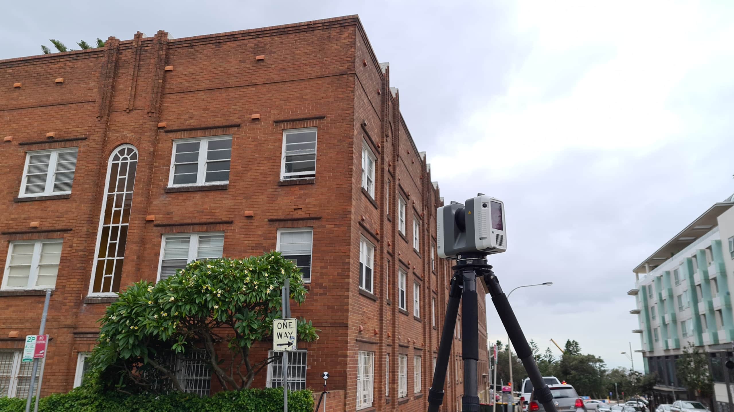
Diospatial’s expert survey and laser scanning technicians reliably and efficiently provide scanning solutions for engineering’s most complex environments. Diospatial combines conventional ground based survey with 3D reality capture and laser scanning. This enables the highest precision outputs and 3D capture of complex indoor environments.
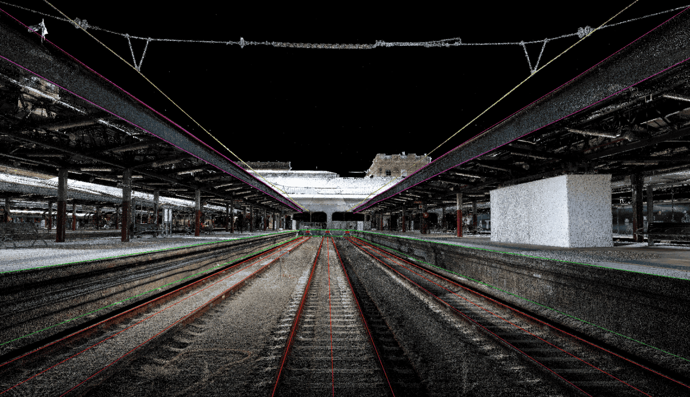
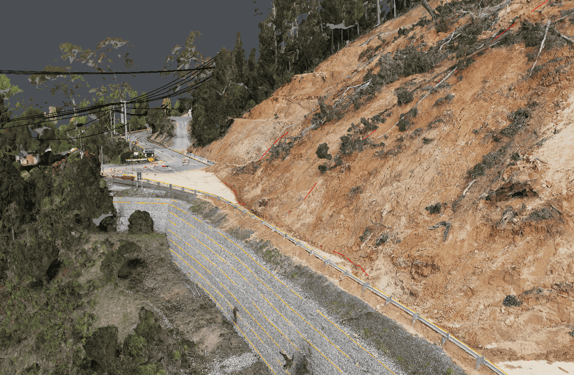
TERRESTRIAL LASER SCANNING SOLUTIONS FOR COMPLEX ENVIRONMENTS WHERE PRECISION AND ACCURACY ARE CRITICAL
Our team of engineers and surveyors work to understand the project context and then develop the most effective methodology – whether that is laser scanning as a standalone service, or as a component of a more holistic reality capture solution.
The outputs can be exploited in any number of geospatial and CAD applications, and most commonly form the basis of a scan-to-CAD or scan-to-Revit workflow.
QUALITY, EXPERIENCE AND TRUST IS WHAT SEPARATES DIOSPATIAL FROM EVERYONE ELSE
Our team is known for delivering the highest quality data and customer service in the industry. A relentless focus on quality control ensures we consistently meet or exceed project specifications. We understand client satisfaction requires client success, and our outcome-driven approach starts at scope development. We work with your team to ensure survey specifications and outputs are optimised to meet downstream user requirements and our support continues beyond delivery to ensure maximum utilisation of the data outputs.
Past Projects
Tunnel Dilapidation Survey
defect mapping of tunnel for pre-construction dilapidation survey using photogrammetry modelling and…
3D Modelling of Rail Bridge
Photogrammetry modelling and terrestrial laser scanning of RAIL bridge for engineering design…
Survey Solution for Flood Recovery Works
Drone LiDAR, orthophoto, conventional survey and services location of 37no. sites to…
Spatial Survey for Windfarm Project
Drone LiDAR, orthophoto, terrestrial laser scanning and survey of project area and…